Before Moldavia Was Formed
Long before Moldavia became a principality, people were already living, travelling and trading across this part of Europe.
The geography played an important role.
The Carpathians lie to the west, while the Prut and Dniester cross the region from north to south.
Between them are hills, forests, fertile land and routes that connected Central and Eastern Europe with the lands further south.
That also meant that different peoples and political powers passed through or controlled parts of the territory at different times.
There was no Moldova yet.
The land that would later become part of the Principality of Moldavia belonged to a much larger and constantly changing historical landscape.
During the 14th century, that began to change.
A new principality emerged east of the Carpathians.
Moldavia had begun to take shape.
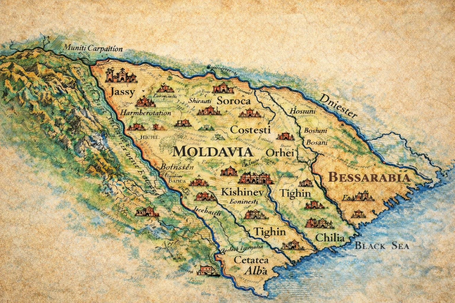
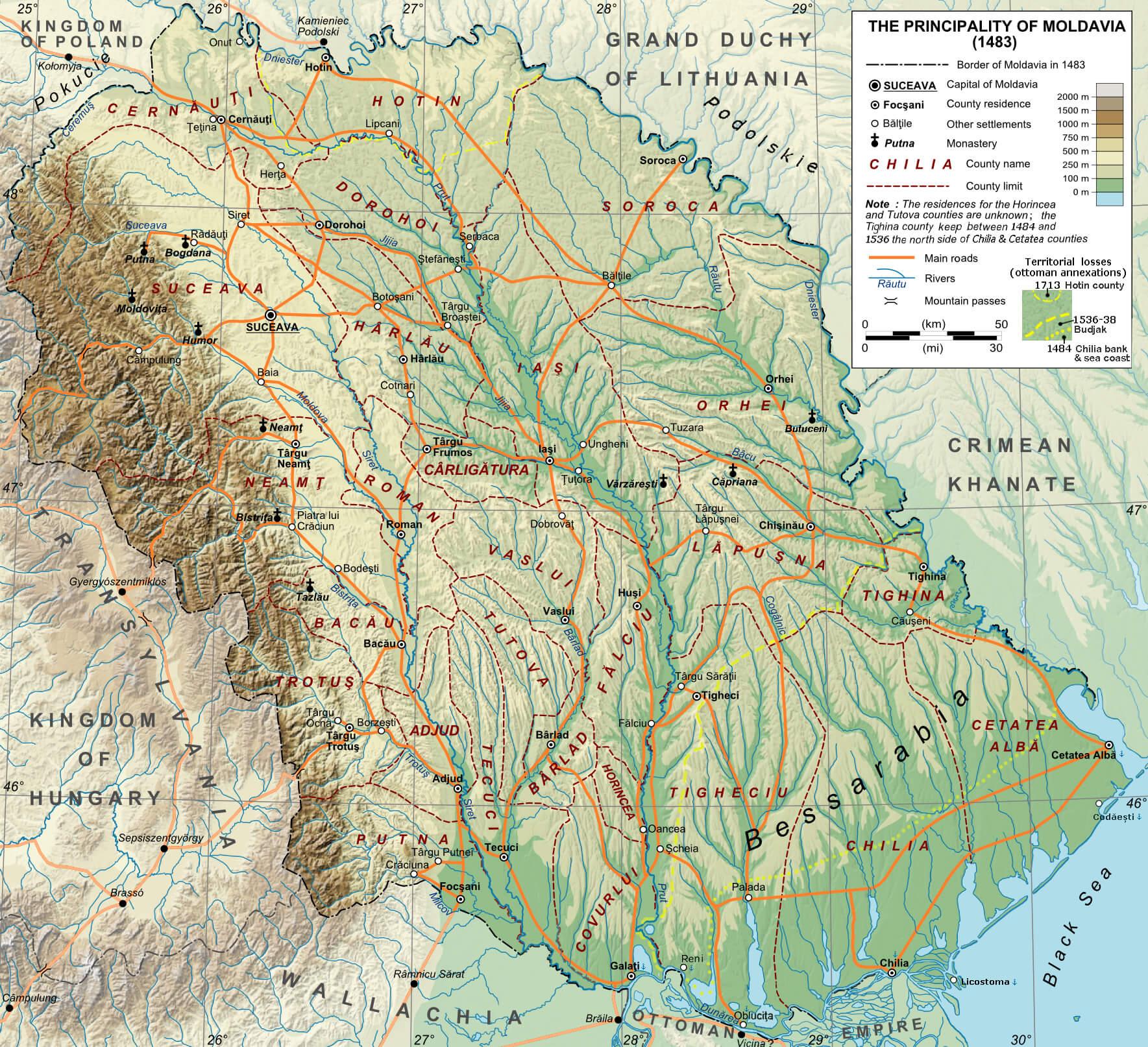
Moldavia Takes Shape
The medieval Principality of Moldavia developed during the 14th century and gradually expanded.
Its territory eventually stretched from the Carpathians toward the Dniester and, during important periods of its history, south toward the Black Sea.
But these were not fixed modern borders.
They changed through wars, alliances, rulers and the influence of neighbouring powers.
Geography still mattered.
The Carpathians formed a major natural boundary in the west.
Rivers provided routes for movement and trade, while access toward the Black Sea connected Moldavia with a much wider world.
Its position brought opportunities.
It also meant that Moldavia repeatedly found itself between larger powers competing for influence in the region.
Bessarabia - A Divided Land
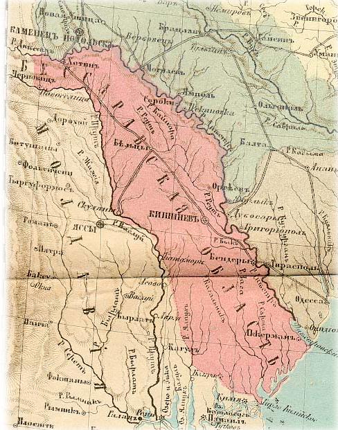
One of the biggest changes came in 1812.
Following the Russo-Turkish War, the Russian Empire annexed the eastern part of the Principality of Moldavia - the territory between the Prut and Dniester.
This territory became commonly known as Bessarabia.
The Prut was now more than a river running through the historical Moldavian lands and had become a political border.
Communities that had once belonged to the same principality now developed under different administrations and political systems.
That division would have a lasting influence on the history of the region.
Toward Modern Moldova
The borders did not stop changing in 1812.
During the following century and a half, the territory passed through several major political changes involving the Russian Empire, Romania and the Soviet Union.
After the Second World War, most of Bessarabia became part of the Moldavian Soviet Socialist Republic, although its borders did not correspond exactly with those of historical Bessarabia.
Some territories were transferred to the Ukrainian Soviet Socialist Republic, while areas east of the Dniester became part of the Moldavian SSR.
Those Soviet-era borders are important because they largely established the territorial shape inherited by the modern Republic of Moldova.
When Moldova declared independence in 1991, those became the borders of the
new state.
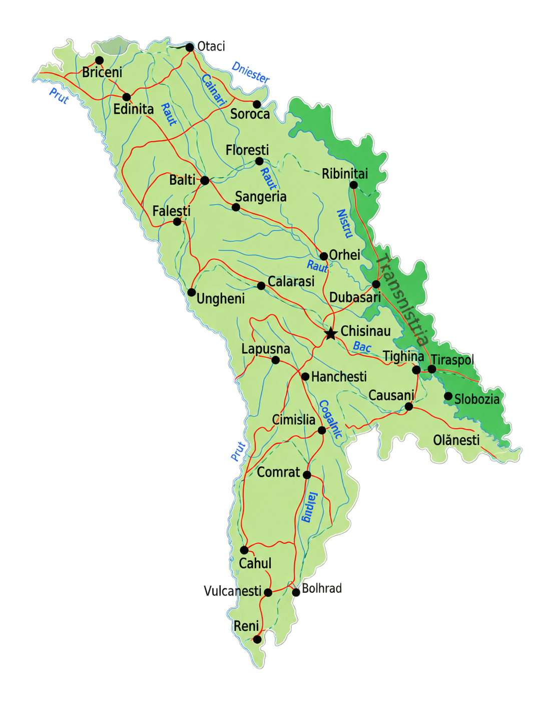
The Moldova We See Today
Look at Moldova on a map today and much of this history is still visible.
The Prut forms most of the western border with Romania. while the Dniester runs through the eastern part of the country before continuing toward Ukraine and-
the Black Sea
Between them lies most of modern Moldova - hills, agricultural land, together with vineyards, forests, villages and cities that developed through all these different periods.
The country's unusual shape was not designed at one particular moment.
It is the result of centuries of changing borders, political decisions, wars and the geography that was here long before any of them.
The names changed, the borders moved, but the rivers, hills and land remained.
Domnitorii s-au schimbat. Granițele s-au mutat.
Pământul a rămas.
-
Rulers changed. Borders moved.
The land remained.